Tuesday, April 30, 2013

Taos (Monday)


It was 38 degrees when I got up this morning about 7:00, and the sun had been up for a while, so I assume it got a little colder than that last night.  As we left the campground, there was a group of 10 deer just down the road.


We drove into Eagle Nest for breakfast, and then headed out through Cimarron to Taos, which took all day.  Eagle Nest sits at the base of the mountains and is in a very pretty setting, although most of the businesses in town have not yet opened up for the summer.


Our first stop was a Vietnam Memorial that is on the outskirts of Angel Fire.  It was built in 1968 to honor the son of Victor and Jeanne Westphall, who had been killed in Vietnam in May 1968.  Also on the grounds was a Huey helicopter that had been active in that war, inserting troops in the Mekong Delta.  Thirteen helicopters had gone down before this one was successful.


I heard some geese fly over early this morning before I got out of bed, and we came upon some of them on our drive today.  You can tell we are still in New Mexico, no lack of artists here.


As we continued on our drive, we came upon an alpaca ranch with literally hundreds of alpacas.  Since we had several next door to us for several years, we weren't too excited about them, but we did get pictures.


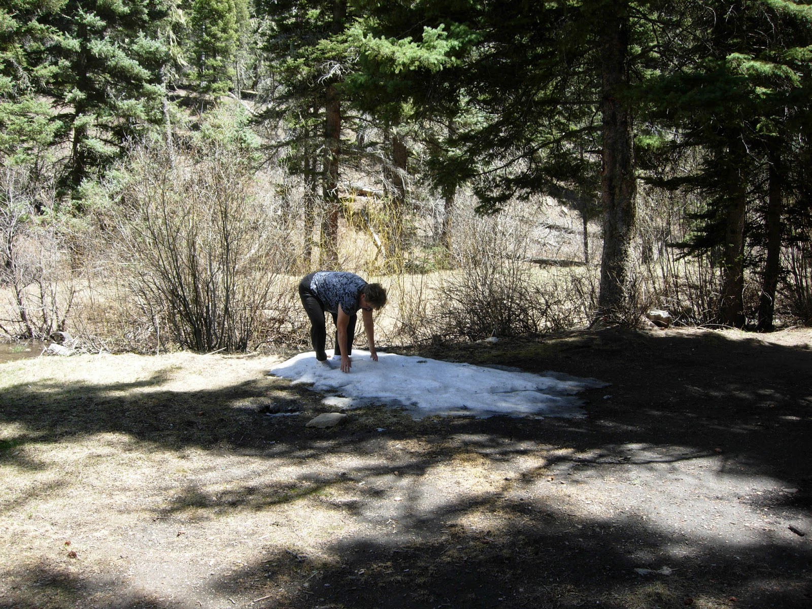
We did see one animal on this part of the drive.  We thought it was a Mexican Grey Wolf, but at the ranger station we stopped at later we were told it was probably a coyote.  But it did not look like our Arizona coyotes.  It was in the middle of a field and Joe turned around so we could get a better look, and a picture, but we spooked it and it headed off to the forest.  We drove past several forest roads on this drive that were closed, but we finally came upon Forest Road 76 and the gates were open, so we drove back there about 5 miles.  We didn't see any wildlife, but we did find a patch of snow, and I hit Joe with a snowball (you can see the snowball in the air if you look closely).  Then I bravely crossed the raging river on a log.  Quite the athlete!!


We finally made it to Taos about 3:00 and headed over to the Rio Gorge Bridge southwest of town.  This gorge is amazing, it's in the middle of nowhere, with no warning that there is this huge canyon.  Joe wondered what those early pioneers thought when they came upon this unexpectedly.


The river looks pretty small from the top, but I'm sure it's a lot bigger at the bottom.  There were signs saying that rafters come through here, but we didn't see any.  They also do hot air balloon rides from here.  I called about that but it was $240 each and you had to be at the bridge at 5:30 a.m., so both of those elements made Joe decide it was not doable.


We came upon this interesting looking campground on the last part of our drive today, with a very nice covered wagon on display.


We went back into town and stopped at the Carson Forest Office to get information on quad riding in case we ever get the chance to come back here.  Then we went up to the Plaza and walked the shops on the square.  We got a recommendation for dinner from one of the shops, so we ate, then headed back to camp.  By now, it's 5:30 so we thought we might be in prime time for wildlife viewing.  But no luck.  We did see one eagle soaring overhead as we neared Eagle Nest.  We were hoping to see some elk in the open valleys but no luck there either. 

However, when we turned into our campground and went around the loop to get to our campsite, four deer jumped over the fence in the campground.  Guess we were looking in the wrong place.

We drove 173 miles in the car today.  The weather was beautiful, although there were some thunder clouds over the mountains as we came home.  It was in the 70s at the lower elevations, such as Taos, but in the 60s up here at our 8000 feet.  We are moving on tomorrow, and our goal is to get out of the state of New Mexico.  We've been gone 1 1/2 weeks are have only made it to our neighboring state, so I think we need to pick up the pace a little, or we will miss Shooter's birth in Florida in June!


Cimarron Canyon State Park (Sunday)

Today we are moving on, we are finished with the Santa Fe area and are heading toward Taos.  There, we want to check out the Angel Fire forest for possible future quad riding.  We did a little housecleaning this morning, and Joe arranged with the forest ranger to open up the dump station for us.  We had a little hiccup there, I tried to turn on our water pump and it wouldn't come on.  Joe started the generator, which meant that our batteries were not dead, so that was good news.  He found a breaker had been tripped, so he got that reset and we were good to go.  We fueled just out of town for $3.219 today, and saw the station where we had fueled the car yesterday had raised their price 5 cents, so we went into the one up the road that we had seen yesterday.  After we left Hwy 285/84, we split off onto Hwy 68 toward Taos.  We followed the Rio Grande river for most of this drive, and saw some rafters drift by.  When we pulled off at a scenic stop later, we could see one of their entrance areas.


They called this area the Rio Grande Gorge, and further north we could see where the river had cut a pretty significant gorge through the landscape.


We hit Taos about 1:00 on Sunday afternoon.  There was quite a bit of traffic, and no place to pull over so we went on through.  It wasn't quite what we expected.  We thought it would be higher in the mountains, with resorts and mountain chalets.  It did have an interesting downtown area that we hope to go back to tomorrow.


We had a recommendation from a co-camper here in Santa Fe to go to Cimarron State Park, which is over by Eagle Nest northeast of Taos, and that was our original plan, but I checked my Passport directory (where we get campgrounds at half price) and found one northwest of Taos that sounded like a possibility.  It had full hook-ups and a laundry, and it is getting time to do that so we picked up 522 in Taos and headed that way.  There is a loop that goes north of  Taos called the Enchanted Circle, and this town (Questa) was on the loop, as well as Eagle Nest, so we headed northwest.I called the RV park and they said they were open but at church right then.  We told them it would be an hour or so before we got there.  When we got there, although it was right on the bank of the Red River, it was not much of a park.  We couldn't raise anyone, and as we drove around, the laundry and showers were all locked up for the season, so we just headed out of there and drove on around that part of the Enchanted Circle to Eagle Nest, and then on to Cimarron State Park. The laundry will have to wait for another day.  From Questa to Eagle Nest, we took Hwy 38.  And we were really glad we did.  The part of the drive after we left Questa was a lot more scenic because we were at a higher elevation.  I went to the kitchen to fix lunch while Joe continued driving, and just after I took our plates up front, we came upon 3 mountain sheep just after we went through the little town of Red River.  So here I am, juggling plates, Joe is trying to get stopped, I'm trying to grab the camera, and all the while hoping these sheep won't run off.  Fortunately for us, they didn't.


This was a really pretty drive, with snow-capped mountains, pine trees, and open valleys.  We came past a small herd of about 10 elk in one valley, but they were too hidden to get a picture.


We drove through Eagle Nest and turned off onto Hwy 64 to Cimarron Canyon State Park.  Like Hyde, this park is not yet open but we called and were told we could still use the park.  There was one spot with electricity (probably for the host who wasn't there yet), and it had a sign that it was available, so we took that one.  The Cimarron River runs through the park and is very pretty, part of it a braided river where it splits into many different channels.


After we got set up, we walked over and just enjoyed the sound of the river running.


While I walked on down looking for any evidence of animal activity (we saw a lot of deer poop), Joe decided to rest on a log.  But it was a mistake, he found it was not very comfortable, and he even got a splinter.  He said he probably injured his ribs again.  But he's fine -- he was just being a wimp.


About 6:00 p.m., we took our Wildlife Viewing Drive through the rest of this state park and on into Cimarron.  The deer were out!  We saw 59 deer, some in herds of 10-12, others just 5 or 6.  None of these deer were very spooky, they just looked at us when we stopped the car.  Even the turkeys took their time getting on the move.


We also saw 3 wild turkeys

.  Actually, we saw 4 but we thought one of them was the same one we had seen on the way to town.


There were sheer cliff walls along this drive too, called Palisade Sill.  They were beautiful, sheer cliffs, pretty awesome, with the sun hitting them just right.


We drove 138 miles in the RV today.  It was 41 again when I got up this morning, but as we headed into Taos and even further north, it was quite warm, in the 70s.  We are camped at an elevation of 8090, and it cooled off quickly when the sun went down.  It was a beautiful day, no wind that bothered us driving, and we saw some pretty scenery and lots of wildlife.  Who could ask for more!

Los Alamos - Saturday

I've noticed that the computer is putting a date on my posts when I post them.  Usually, that is not the same day as our Adventure, so I will try to start putting the day in the title.

Since we felt like we had seen most of Santa Fe when we came in on the train, we decided to take a scenic drive today.  Joe found a loop drive heading northwest that would take us through Los Alamos, so after a stop at McDonalds to post yesterday's blog, we headed out.  Our next stop was for fuel for the car at Camel Rock gas station, where we paid $3.29.  Just up the road we saw it for $3.219 so we will fuel the RV there tomorrow when we head to Taos.

.
We took Hwy 285 out of town, then turn off on 502 to Los Alamos, crossing the Rio Grande River again.


Neither of us knew much of the history of Los Alamos, so it was just a fluke that we took that route.  But it was very interesting.  They have a walking tour that takes you past most of the historic buildings from when the Manhattan Project was underway here.  I didn't even know what the Manhattan Project was -- but it was the making of the atomic bombs that ended World War II.  We stopped at the Visitors Center, and after we drove/walked the walking tour, we spent an hour or so at the Scientific Museum. We started the walking tour at Ashley Pond.  This area was originally a Ranch School for sickly boys but was taken over by the government to establish a location for the secret building of the atomic bombs.  Scientists from around the world game to Los Alamos to make this happen.

It wouldn't be New Mexico without some art work, and some beautiful sculptures surrounded Ashley Pond.


The walking tour included Bathtub Row which housed the scientists, so named because those residences were for the original faculty of the Ranch School and had the only bathtubs in town.  There were also the remains of a ancestral pueblo dwelling (roughly 1225 CE), and a fire house where the man-powered fire pump truck was stored.


The museum was wonderful.  It had two films showing, one about the history of making the bomb and the current mission to maintain our country's aging weapons without nuclear testing, and the other about the community itself from 1942-1945.  On display were the two bombs, the Fat Man, which was named after Winston Churchill, and dropped on Nagasaki, and the Little Boy, which was dropped on Hiroshima.


We finally decided it was time to move on, so we got a bite to eat and headed out.  We backtracked to pick up a little side road, Hwy. 4, and followed it on for several miles, through the Bandelier National Monument (we drove through the campground there), and the Jemez State Monument.  On this drive we finally spotted some wildlife -- 2 deer.  A welcome sight! 

This drive took us through the Valley Caldera National Preserve, a beautiful valley where elk roam.  We lucked out and saw a herd of about a hundred (quite a distance away), then we drove back into the preserve as far as we could.  We saw another herd of about 20, and a couple more off by themselves.  The Jemez River runs through this preserve, and we followed that river for miles.  There was a lot of fishing on it, even though it looked like little more than a stream in some places.


Prarie dogs are also plentiful in this preserve.  I saw a couple when we first stopped, and one of their holes.  Then as we were driving out, we came upon their prairie dog farm, must have seen 20 there popping up and down out of their holes.


When we came out of the preserve, Joe spotted a forest road a few hundred feet back, so we decided to see if we could see any more elk in there, because the lady at the preserve said they usually cross over from that side about dusk (we were a couple hours early).  We drove back in there about 5 miles, then turned around and took another side road that took us back to the highway.  This whole area had been destroyed by a tremendous fire back in May 2000, the 48,000 acre Cerro Grande wildfire.  There was a monument commemorating the fire and community re-building in Los Alamos, but we never found it.  Whether that was the same fire that destroyed this forest we don't know, but the damage was sure evident.  They were logging in some areas, quite a large operation.


As we were driving out of a parking lot, I asked Joe why our car squeaked so much.  He said, "well, it's elderly." 

We didn't see any wildlife on this forest road, but just after we turned back on the highway, Joe spotted two elk back in the trees.  We continued our drive, which took us through many Native American communities (speed limits 25, 30, 35).  It took us a long time.  A guy driving an oncoming car held up 2 fingers as we passed each other, so we spent the next 20 miles looking for 2 animals of any kind.  We never saw anything though.  Along this route, though, were beautiful mountain cliffs which were mauve and pink, then the terrain changed to the red of Sedona.   We finally connected with Hwy 550 that took us back too I-25, about 40 miles south of Santa Fe.  In fact, we were just north of Albuquerque and we could see the Sandia Casino where we had stayed in Albuquerque.  We got back into Santa Fe about 7:30 and had dinner, then headed back to camp in the dark.  It was a long day, but an Excellent Adventure.  We probably drove between 150 and 200 miles in the car. The town of Los Alamos and the elk in the wildlife preserve were the highlights.