July 2-3 (Friday-Saturday) We left Denali Park and headed down to Cantwell, then across the Denali Highway, also called the Cantwell Highway. This is a 135-mile road, with only the first 3 miles and the last 20 miles paved. Most of the time Joe was driving around 20 mph, plus or minus. Before we got onto this highway, a bald eagle flew up from the ground, right beside us.
The road had lots of small potholes, and was washboardy in many places, but all in all, it wasn't too bad.
I had one other fact from the Denali Park that I wanted to write down regarding the Dall sheep there (I lost my note when I did that blog). There are approximately 2200 sheep in the park. The rams have horns that curl in 5-7 years, and then they become a trophy. The ewes horns do not curl. The one lone ram we saw on the very top of a ridge had a beautiful set of curled horns on him.
On the Denali Highway, the first noteworthy thing we came across was Joe Lake, which they use for flightseeing. Joe thought we definitely need a picture of this, even though we couldn't find a sign calling it "Joe Lake."
We drove past miles of brush along the road, and out in the middle of nowhere, someone had decorated a bush like a Christmas tree.
Joe and I are still fighting colds, but I felt quite a bit better today, so I think I am on the mend, with occasional coughing spasms. Joe, however, is still feeling pretty rough, and he is still doing a lot of coughing. Hopefully, by tomorrow he will begin to feel better.
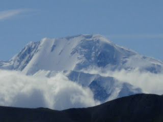
We had hoped to see some wildlife on this drive, but all we saw was a ptarmigan, and a moose running in a river valley, a long ways off. But the scenery was beautiful, with views of the Alaska Range and some glaciers.
We got on the road about 9:30 this morning, and drove 109 miles. We found a spot just off the road about 3:00 to camp. In exploring the area around our campsite, we came across an animal hide, we think it was a caribou. The pictures are a little gruesome.
We don't know if this animal was killed by hunters or by another animal. This camp spot is used by hunters, and there was a pair of rubber boots by the carcass, so we assume it was hunters who left the hide.
Shortly after we got set up for the night, it started raining again, and we got to see our first Alaska rainbow, then a double rainbow. The first rainbow was really brilliant.
It rained most of the night but our camp spot had enough gravel that we didn't have any trouble pulling out on Saturday. It was really foggy for a while, but we were able to see another glacier.
We saw several beaver lodges in ponds, a couple snowshoe hares and several trumpeter swans as we continued on. We made a pie stop on behalf of David about 11:00. This place had an awesome statute of a bear, so we knew it would have good pie.
This place was expecting a Princess tour bus in about any time, so we finished up and got out of there. They had a gift shop and dog kennels across the river, but we didn't stop there.
 We were driving in the clouds for a while as we topped the MacLaren Summit at 4,086 ft. This is the second highest pass you drive over in Alaska, the first one is the Atigun Pass on the Dalton Highway (which we also went over). The clouds were really impressive, and the landscape was speckled with pools, creeks and rivers.
The valley in the photo below was just beautiful. It actually has a river running between the mountains, but that doesn't show up in this picture.
Then our first mis-adventure of the day happened. David had a front tire go down on his truck, just 1/4 mile before we hit pavement again. So Joe helped him get that changed, and there happened to be a tire repair shop a mile down the road, so he stopped in there and had it patched. We paid $95 in Canada to get a tire fixed; he got by for a measly $20.

Back on the road again, and now on pavement, we went through a region called Tangle Lakes. This lake is one of a series of narrow lakes connected by the Tangle River. There were a lot of quad riders in this area, and a lot of people camping along the road.
Finally, we hit the main highway (Richardson) and headed south to Glenallen, then east toward Anchorage. We are camping tonight 14 miles east of Glenallen, right on a creek. In fact, our RV is backed up right to the edge of the creek. It's raining again, and I sure hope this creek doesn't rise tonight.
Glenallen has a 4th of July celebration so we are planning on driving back in tomorrow to take part in the festivities. There is a parade at 10:00 a.m., and they close the highway for it so we have to get our timing right. It will be interesting to see how Alaska celebrates, since it never gets dark here in July.


