Friday, June 14, 2024
Around Havre, MT
We took it easy this morning but about 12:30 we headed into Havre to check out the highlights in town. We found a Mexican restaurant for lunch that was pretty good. We hadn’t had Mexican for a long time and it was nice to get a good Mexican meal. We stopped at the historical Underground "Havre Beneath the Streets" museum and just missed the tour, so we’re going to try to make the next one at 3:30.
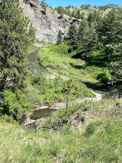
In the meantime, we decided to drive the Beaver Creek Road, the other item on our check list for Havre. We had about 1 1/2 hours to make it back, and it's about a 30-mile trip down a good highway, but I was pretty sure we would not make it back in time. (Probably be dirt roads along the way.) We stopped at one point and hiked down to Rotary Falls Access which took all the energy we had. It was probably only a 10-minute hike each way but parts of it were pretty steep and pretty rough. There was a lady with two kids coming off of this trail to the Falls as we pulled up so I asked her how far it was. She said they had just gone to where they could see the falls, but it wasn’t too bad. Joe now wants to put out a warrant for her arrest for misinformation.
It was a struggle.
After we managed to get back in the Jeep, we continued our drive. The next road led to Bear Paw Lake. As we crossed the little bridge, we could see part of the falls (they were not much).
The lake was gorgeous, and there were a lot of campsites around it. Some individual campers on points, then a row of them in another area. This would have been a great place to camp had we known about it. That's the problem with these little gems, only the locals know about them unless you have traveled through here before.
The brushy area behind the lake would be great for wildlife, but it's mid-afternoon, not a good time for wildlife to be out and about.
Some of the campsites looked like that had electricity at least, possibly full hook-ups.
This was a very pretty drive. Parts of this area on this drive look like the Big Lake area in Arizona (the prettiest part of Arizona, in my opinion) with the rolling hills and mossy-looking ground cover. Lots of wildfires blooming along the road and on the banks, yellow and purple and white. And pretty little Beaver Creek just keeps tumbling along from one side of the road to the other. I wanted to stop and walk down to it, maybe put my toes in the water, but we never did stop.
We got back to town, made a trip to Walmart, then headed back to the RV. That little, steep hike really wore us out so we were done for the day. We were able to make reservations for our next campground while we were in town, so we will be heading to Great Falls on Sunday. We don't have a phone signal at the campsite and I had a hard time connecting with the next campground, so it was a relief to get that settled.


No comments:
Post a Comment