
Wednesday, June 26, 2024
Across the Border.
We didn't have much of a plan for today. Thought we might drive east from Babb to Duck Lake. But when we headed up the highway, we saw a sign to the Chief Mountain Border Crossing and Waterton Lakes National Park so we took that road. Which led us to the border crossing at Chief Mountain and into Waterton Lakes National Park in Alberta, Canada. This mountain is 9,080 feet and stands ahead of the other mountains on the eastern edge of the Rockies and looks over the plains. Lying half in Glacier, half in the Blackfeet Reservation to the east, and just under 5 miles from the border that passes through the Peace Park, the mountain transcends boundaries. We could see this mountain from many places in the park, and it seemed to always have a ray of sunshine on it. It towers about the land and is very impressive.

It was a good thing we had our passport cards in our wallets because we had not planned to cross the border today. We had been debating about whether to drive to this Park in the Jeep or move the RV up here, so now we get to check it out first. We were here 14 years ago but who can remember???


.
We passed the sign to the entrance to Glacier National Park. Then we came to the border crossing. There was a pylon blocking the exit so Joe wasn’t sure we could come back out, but then when we pulled up to the entrance, the border patrol agent just moved a pylon in front of us as he went into his shack so we figured that must be how we get out. We found out that this entrance is only open for three months, they close in September. But right now they are open from 7 AM to 10 PM. So, just like that, we’re back in Canada. They only asked about firearms, tobacco, and alcohol and we didn’t have any of those so we were good to go. We were afraid they might take our cherries and apple in our cooler, but they didn’t even ask. We will see what happens when we cross back into the US.
As we came through the entrance to Watertown, we saw two elk up on the ridge. There were distant but through the binoculars we could tell they were elk. Too far away for a picture. But we had a pretty river to drive beside (Cameron, I assume).

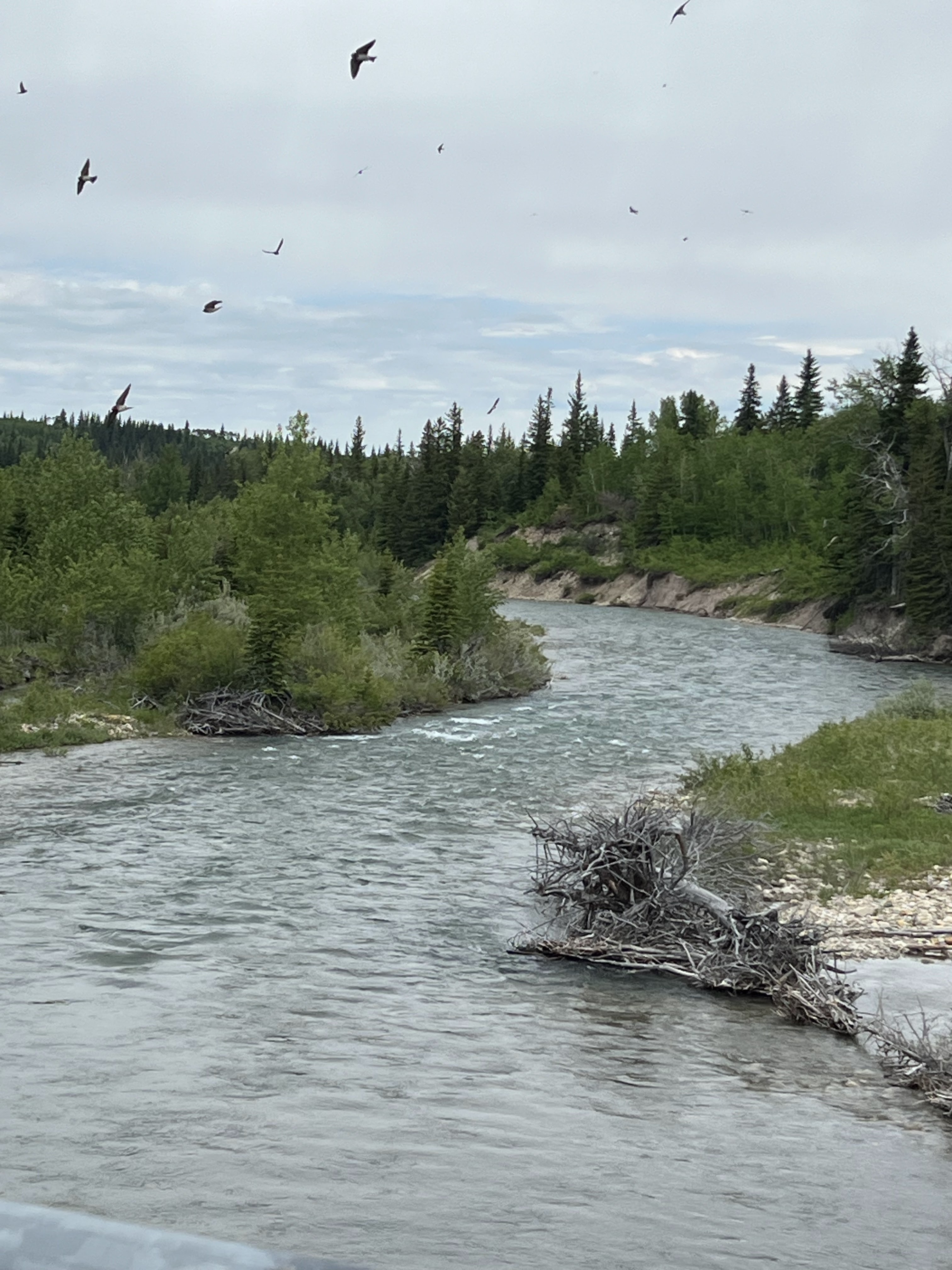
We saw a group of trail riders just heading out. Unfortunately, those days are gone forever for us.

As you enter town, you cross a bridge with Cameron Falls crashing down the cliff.

We drove into the little village, looking for the campground we had stayed at before. We found the campground but drove completely around it twice, trying to figure out how to get in to see if we can we make a reservation here. We finally found the opening and stopped at the booth. She could not make reservations but could check on availability. And there was nothing for Sunday night, so we decided to see what we could today, then move on down the road on Sunday.
Prince of Whales Lodge sits at the top a hill next to the Waterton Lake. The Lodge is beautiful but not as luxurious as one might expect. We went into the lobby, checked out the gift shop and restaurants, then left. They do serve tea in the afternoon for about $60/person. There were beautiful hanging baskets on the outside of the front entrance.


This is the view from the parking lot.

Deer wander freely in town, we saw three -- two lying down in yards, one walking in front of a little restaurant. This is one thing I remembered from our other trip here. We even had to watch our step in the campground to keep from stepping on deer droppings then.


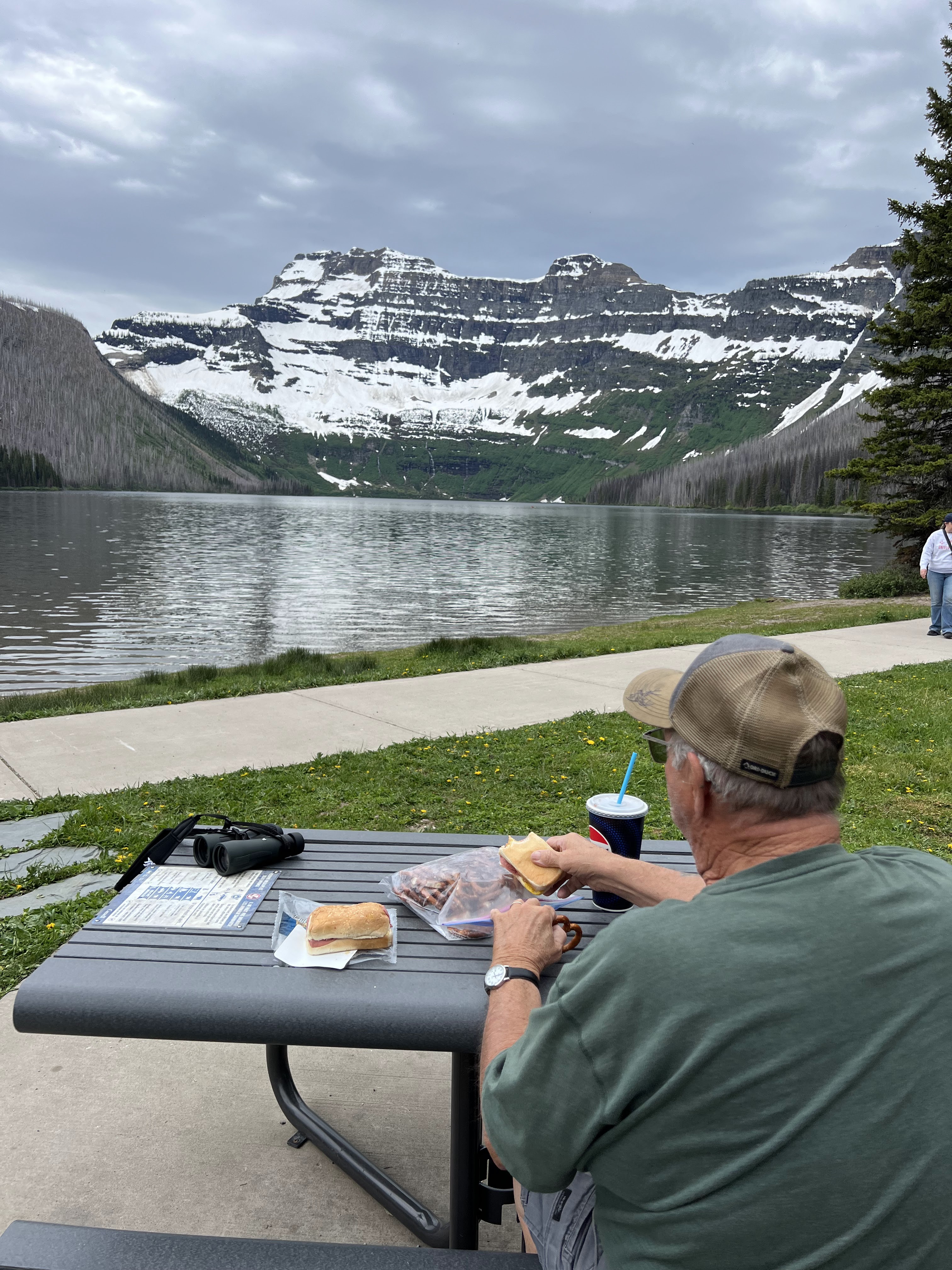
I bought a sub sandwich in the little Village while Joe fueled the Jeep, and then we took a drive to the end of the Cameron Lake Road which we think was about 9 miles. This is a pretty drive, still have snow-capped mountains to look at.

We had our little picnic at the lake, fighting the bugs, but it was a very nice view. We never seem to be smart enough to put on bug spray or take umbrellas or any of those basics that most people know to do. Just as we finished and got up from the picnic table, it started sprinkling so our timing was good on that. Kids were playing in the water down by the dock, and the guy in front of us decided to stand in the water. Not sure what that was all about. There’s more waterfalls on these roads and you can see the water streaming down the mountain as the snow melts. The town site is actually a little village with stores and shops, a gas station, ice cream places, lots of Airbnb’s and camping motels, residences -- cute little town with deer in the yards. Joe gave the Waterton Village an A+ because they had fountain Diet Coke.


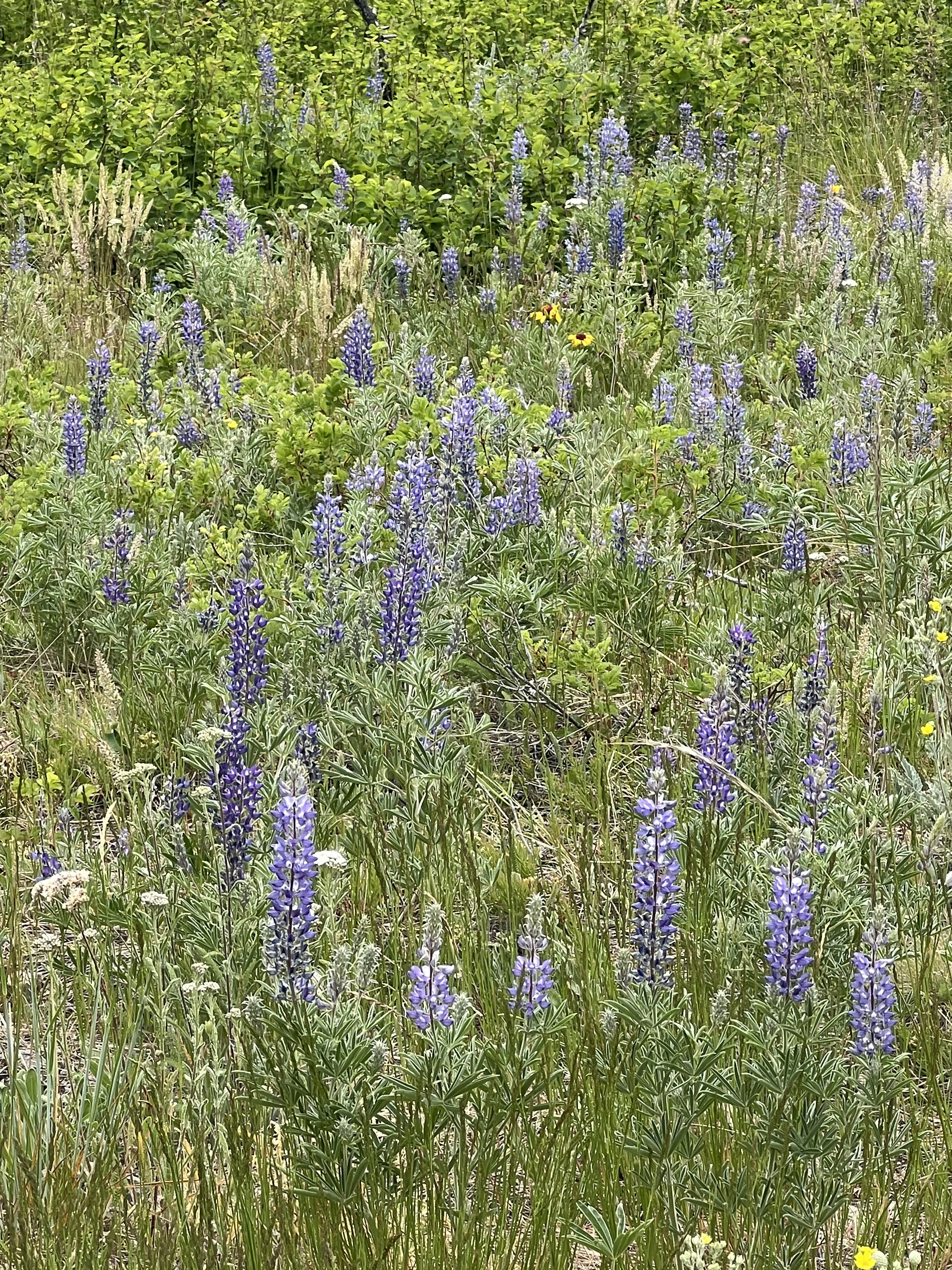
Next, we drove back Red Rock Canyon Road. It actually was a prettier drive than Cameron Falls because we were down in the canyon the whole way, following beside another river or creek, mountains on both sides. We stopped at an overlook and actually walked down to the deck. There were lots of wildflowers blooming along here, and a sign at the overlook identifying them and describing how they are used by which animals.


We got to the turn-around and found the red rocks. There was a bridge over the Blakiston River, so we got out and watched the kids playing in the water. Andrew and Catalina would love it here. It sprinkled on us a little, but still no animals except the two elk at the entrance and the three deer in town.


When we came through the exit of the park, we pulled over to a viewing area to see if we could still see our elk. As it turned out, there were nine of them now. They were quite a distance away, but it was fun to get to see them.

When we exited the park, we took the road to Pincher Creek. Just a couple of miles up the road was a buffalo paddock so we drove that loop. We counted 19 buffalo, including three babies. The buffalo were right inside the fence at the beginning of the loop, but we drove the entire bumpy dirt road around to make sure there weren’t more. We finally turned around and headed back out through Chief Mountain and home at 5 o’clock.


We crossed back into the US at 5:23. No problem getting through border patrol. Joe ate the cherries on the way just in case, but they didn't take anything. The first picture is the Canadian Border Crossing, and the second one is the U.S.


It was getting to be a long day, so we stopped on the way back at Sisters Cafe for dinner. Eating out is extremely expensive up here -- short season, I guess. It was 7:00 by the time we got to the RV. We put in 144 miles today.
Now that we have eliminated Waterton from our next travel plan, we need to find a place to stay starting Sunday. The July 4 holiday snuck up on us, so that will have to figure in to the mix. Tomorrow's assignment.
Looks like a great side trip to Canada. The trail riders and elk must have been fun to see. - Paul
ReplyDelete